100 Years Lia Rumantscha

This year is a festive period for the Lia Rumantscha, the Romansh organisation. The organization is committed to the Romansh language and culture since 1919. The Lia Rumantscha organizes a language and culture festival in Zuoz in the Upper Engadine. It will take place in August.

The programme offers events on various themes of the Romansh language and culture. There is for example the Di da famiglia (4.8.2019), a day at Grischun triling (11.8.2019) and the Festa da 100 onns (17.8.2019). In the evening the theatre production will be shown.

(Source: www.liarumantscha.ch).

Morat, Burgundy, the Obelisk, the Panorama the Eidgenossen

Morat (Murten in German) is one of the cities that, by the fate of history, belongs to the canton of Fribourg (Freiburg).

The Dukes of Zähringen founded the city in the second half of the twelfth century, in the same period as the foundation of Bern and Fribourg.

The Burgundian wars (1474-1477) were crucial. The city chose Bern and Freiburg against Burgundy and Savoy in 1475. After the defeat of Burgundy in 1476, the city was ruled by Bern and Freiburg until 1798.

The Duke of Burgundy besieged Morat after the defeat in March 1476 at Grandson; Burgundy suffered another crushing defeat on 22 June. The Duchy lost for the third time in 1477 (at Nancy). Duke Charles the Bold (1433-1477) died in combat, and the Kingdom of Burgundy never materialised.

Morat was assigned to the canton of Fribourg by the Act of Mediation (1803).

Lord Byron (1788-1824) wrote in 1816:

„While Waterloo with Cannae’s carnage vies, Morat and Marathon twin names shall stand;
They were true Glory’s stainless victories,
Won by the unambitious heart and hand
Of a proud, brotherly, and civic band, …. ”

The Obelisk of Meyriez (1821)

The famous Panorama (1893) by Louis Braun (1836-1916) is on view in Museum Murten.

Picture: Panorama de la Bataille de Morat 1476

The Prince-Bishopric of Basel till 1813

The history of the bishopric of Basel (Basilia in Roman times) goes back to the Roman Empire. In the fifth century, the bishop moved from Augusta Raurica (Augst) to Basel, prompted by the invasions of Germanic tribes (Alamanni). The hill in Basel offered an excellent refuge and had some defensive walls.

The ancient palace of the bishop in Augusta Raurica (Augst)

The bishopric led a politically and culturally inconspicuous existence until the time of the Empire of Charlemagne. The bishops Wado and Haito (762-836) were advisers of Charlemagne and initiators of crucial cultural changes.

The diocese acquired the rights of Moutier-Grandval Abbey in 999 as a gift from Rudolf III (971-1032), the last king of Burgundy. The bishop became the vassal and Prince of the Holy Roman Empire in 1033. It was the beginning of the Prince-Bishopric of Basel, which formally lasted until 1803.

Emperor Henry II (953-1024) financed the renovation of the Münster in Basel, the cathedral. The Prince-Bishopric became the most powerful state on the Upper Rhine by acquiring St. Ursanne Abbey in 1146 and conducting military expeditions in the thirteenth century.

Delémont, Musée d’art et d’histoire. 

The possessions encompassed the Jura, the Sundgau, southern Alsace, Birseck, Birstal, and territories south of Germany.

The Eidgenossen confiscated the southern part of the Jura and the cities of Biel and Moutier in 1476 and 1477 (after the Burgundian Wars). The northern part of the Jura and the cities Délemont, Porrentruy, and St. Ursanne remained the possession of the bishopric.

The town hall (Rathaus) of Basel

When Basel joined the Eidgenossenschaft in 1501, the relationship between the bishop and the city council became increasingly complex. The Reformation forced the bishop to move his seat to Porrentruy (Pruntrut in German) in 1527. The Chapter went to Freiburg im Breisgau and in 1678 to Arlesheim.

The architecture and grandeur of Porrentruy bear witness to the splendour of the prince-bishop and his court. The Treaty of Westphalia (1648) caused a further (political) separation between the northern and southern parts of the Jura.

Delémont (Delsberg), the castle of the chapter and the bishop’s summer residence 

The prince-bishopric’s area (including the northern part of the Jura) remained a Catholic principality of the Holy Roman Empire. Protestant Bern kept its possessions in the southern part of the Jura.

The world would no longer be the same after 1792. Five political constructions succeeded in 13 years.

Collection: Musée jurassien d’art et d’histoire, Delémont

1792-1815

In 1792, the northern Catholic part of the Jura became the French République rauracienne. In 1793, this region merged with the French department Mont-Terrible. In 1798, France annexed the southern part of the Jura to this department.

In 1800, the whole area of the prince-bishopric was added to the Haut-Rhin department. This situation remained until Napoleon’s defeat. In 1813, Allied troops occupied the area, and Arlesheim was the seat of the Allied administration.

The four great powers decided to divide the territory of the Prince-Bishopric between Bern and Basel at the Congress of Vienna (1814-1815). Bern got the entire area and the Laufental of the bishopric, minus Birseck, as compensation for losing other places (the new cantons of Vaud and Argovie). The Birseck was assigned to the canton of Basel.

Delémont, Musée d’art et d’histoire. 

The new canton of Jura was founded in 1979 to separate from the canton of Bern. In 1833, the Birseck joined the new canton of Basel-Landschaft. The Laufental left the canton of Bern in 1994 and joined the canton of Basel-Landschaft in 1994. Due to the referendums (2017 and 2021), Moutier will leave the canton of Bern in 2026 and become part of the canton of Jura.

(Source: A. Berchtold, Bâle et Europe. Une histoire culturelle, Lausanne 1990)

See also the Bishopric of Basel after 1815

Delémont, Musée d’art et d’histoire. 

Romont Castle

The castle of Romont was built in 1240 by Pierre II of Savoy (the Little Charlemagne, 1203-1268). The castle houses the glass museum (Vitromusée) nowadays. The museum has a unique stained glass collection from the Middle Ages, Renaissance, Art Nouveau to contemporary works.

(Quelle: F. Guex, Romont, Stiftskirche und ehemalige Kapuzinerkirche, Bern, 2014).

Urbanism and the watchmaking industry

Since 1705, the Neuchâtel Region has been producing watches and clockworks. This watchmaking industry has shaped the way cities live and even influenced town planning.

The cities of La Chaux-de-Fonds and Le Locle embodied the urban and architectural unity dedicated entirely to clock and watch production, as they were built by and for this industry.

Before the Industrial Revolution took off in the nineteenth century, small villages dominated, and farming was the most important economic activity. The

Espace d’urbanisme horloger is a multimedia space devoted entirely to the watchmaking town planning of La Chaux-de-Fonds.

This event is the key to understanding the origins of the city’s status as a UNESCO World Heritage site and offers an exhibition and a film highlighting the city’s impressive industrial heritage and unique urban concept.

(Source and further information: www.timExplorer.ch).

The vineyards of Lavaux

The vineyards of Lavaux, also known as the Lavaux region, are often referred to as the “Land of the Three Suns”: the sun from the sky, the sun reflected from Lake Geneva (Lac Léman), and the sun absorbed by the walls, which acts as a heat source.

Lavaux’s landscape is one of the most extensive vineyard areas in Switzerland, encompassing 14 villages. It is located in the Canton of Vaud, on the shores of Lake Geneva, between Vevey and Lutry, and is a UNESCO World Heritage Site.

(Source and further information: www.lavaux-unesco.ch)

Dornach, 1499, Nepomuk and Schwarzbubenland

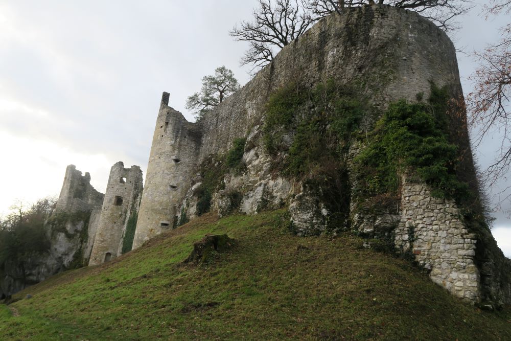
Schwarzbubenland consists of the Dorneck and Thierstein districts in the Solothurn canton. Dornach is derived from Tornacho, Tornegg, or Tornach, the Celtic-Latin name for a type of fundus turranicus. A Gallo-Roman settlement existed in the first centuries AD.

The medieval ruins of the castles Dorneck and Hilzenstein, the Goetheanum, the monastery, and the Nepomuk bridge have stories to tell. A flood destroyed the bridge in 1813, and only the statue of St. Nepomuk remained intact.

Das Goetheanum

The High Rhine Region

The High Rhine (Hochrhein) region stretches from Lake Constance to the Upper Rhine and is bordered to the north by the Black Forest and to the south by the Swiss Jura.

The High Rhine leaves Lake Constance at Stein am Rhein and becomes the Upper Rhine in Basel. The Rhine flows 150 km through various landscapes, including narrow gorges, sparsely populated agricultural areas, port facilities, and industrial zones.

This region was a cultural, linguistic, economic, and political German-speaking unity under Habsburg rule, as well as during the Roman and Carolingian/Frankish periods.

Several cities, such as Rheinfelden, Kaiserstuhl or Laufenburg, bear witness to this bond, although the region today encompasses three countries.

(Source and further information: (Marie-Louise von Plessen, Der Rhein, eine europäische Flussbiografie (Bonn, 2016), Erlebnisraum Hochrhein : www.baselland-tourismus.ch).

The Basler Dance of Death and the Mengele Dance of Death by Tinguely

Until 1805, one of Basel’s most famous attractions was a mural depicting a life-sized Dance of Death on the wall of the lay cemetery of the Dominican monastery.

The procession of thirty-seven pairs engaged in a danse macabre embraced people off all ages and members of all medieval estates, from pope to hermit, emperor or beggar. Each pair was accompanied by an inscription in verse in which Death himself addressed his condemned partner.

Basel, Museum Kleines Klingental. Der Totentanz.

purpose of the mural was to impress upon people the omnipresence of death, the brevity of life and the equality of all men in the face of their morality. It served as a visual admonition to all those who saw it to mend their ways and do penance. The mural was painted during the Council of Basel (1431-1448).

In 1773, 32 years before its destruction in 1805, the topographer Emanuel Büchel (1705-1775) painted and mentioned the Basler Totentanz image by image in an album. Johann Rudolf Feyerabend (1779-1814) painted the Totentanz in 1806. He based his paintings on this album.

Basel, Weberstrasse near the Klingentalkloster, wall painting on a house

(Source and further information: F. Egger, Basler Totentanz, Basel 2009; historisches Museum Basel).

Emanuel Büchel, ganz oben “Tod mit Kaiser”, aus dem Klingentaler Wandmalereizyklus, Aquarell auf Papier. Kunstmuseum Basel/Martin P. Bühler, Kupferstichkabinett, Skb A 48 H. Foto: TES

The Basler Totentanz,  Matthäus Merian (1593–1650),  ‘Todten-Tanz, wie derselbe in der löblichen und weitberühmten Stadt Basel zu sehen ist”, around 1621. Collection: Historisches Museum Basel, inv. 1932.1162 

Jean Tinguely, Mengele Totentanz, 1987. Tinguely Museum Basel

Johann Jakob II Schneider (1882–1889), die Predigerkirche und der Abbruch der Friedhofsmauer, nach Constantin Guise (1811–1858). Inv. 2004.199

Daniel Burckhardt-Wildt (1752-1819), Abbruch des Totentanzes, 5. August 1805. Inv. 1950.103. Collection: Historisches Museum Basel

Saved wall paintings from the Predigerkirche.

Twenty-three fragments were saved and nineteen of these found their way into the collection of the Historical Museum Basel

Collection: Historisches Museum Basel