Grand-Hotel Giessbach

The Grand Hotel Giessbach is near the famous Giessbach-waterfalls between the mountains and the Lake of Brienz.

Many visitors were rowed across the lake to the waterfalls around 1800 by the famous Brienz women rowers. The Giessbach-waterfalls were lit in the evening from 1840.

The Grand-Hotel Giessbach was renovated by the architect Horace Edouard Davinet’s (1839-1922) in 1873, including its gasworks, a large laundry, several baths, several bathrooms and a covered walkway in ‘foresto-rustico’ style.

To make the hotel more accessible, the owners also built a funicular from the boat landing to the hotel in 1879. The first electric lights came on in 1884. The hotel closed in 1979, however.

The foundation Giessbach acquired the Giessbach Hotel and its property. A year later, the hotel was reopened with the financial support of the office for the preservation of historic buildings (Denkmalpflege).

(Source and further information: https://swiss-historic-hotels.ch).

Sounding Soil

What does the earthworm say to the springtail when they meet beneath the carrot field? Can you hear the grass growing? What are the differences in sound between a vegetable field with organic soil and one with conventional ones?

The exposition Sounding Soil (au Centre Pro Natura de Champ-Pittet, Cheseaux-Noréaz, canton de Vaud) answers these questions using a sound installation.

The installation, housed in a shipping container with a 3D Loudspeaker System, makes you feel like you are in the soil and walking between the roots and animals. Visitors can touch the various screens to hear a range of soil recordings.

The sound installation makes it possible to experience two basic things. You can listen to the diverse life in the ground, and the differences between soils can be heard: healthy soil with high biodiversity has more sound variety.

Workshops about this theme are organized by the Biovision Foundation.

(Source and further information: www.soundingsoil.ch)

Canton of Neuchâtel

The last Burgundian King founded the castle novum castellum in 1011, hence the name Neuenburg/Neuchâtel. The newly formed borough soon expanded into the Jura upper valleys.

1100-1798

The county of Neuchâtel was founded in the 12th century. Its size reached around 1500, which is the size of the present-day canton of Neuchâtel. Colombier, Valangins, Corcelles, Môtier, Auvernier, (Val de) Travers, Nugerol, Boudry, Le Landeron, Bevai,x, and other towns and villages were autonomous seigneuries or towns with monasteries.

La Chaux-de-Fonds, Le Locle, La Brévine, La Sagne, Les Verrières and other towns in the upper Jura region were founded in this period.

Neuchâtel was strategically located at the foot of the Jura and Lake Neuchâtel and the trade routes to the Franche-Comté and Burgundy, the route to (the Prince-Bisdom) Basel, Morat and Seeland.

Neuchâtel became part of the Holy Roman Empire in 1032 and was ruled by the dynasty of the Counts of Neuchâtel until 1395.

Neuchâtel was an Earldom until 1395. Neuchâtel was subsequently ruled by the German Houses of Freiburg and Hochberg (1395-1504), the French dynasty d’Orléans-Longueville (1504-1706) and by the Prussian King (1707-1856), with a short intermezzo of the occupation by Swiss Confederates (1512-1529) and the government of the French marshal Alexander Berthier (1806-1813).

1798-1857

Neuchâtel became a Swiss canton of the Confederation in 1815, retaining its status as a principality under the Prussian King. However, this hybrid status threatened European peace in 1856, known as the ‘Neuchâtel Affair’.

The Swiss Federation mobilised its troops when the King of Prussia, Prince of Neuchâtel, claimed his property. An attempt to thwart the Prussian monarchy had already been made in 1831. What failed in 1831 was a success in 1848. It provoked a monarchist coup d’état in 1856.

The great powers of Russia, England, Austria, Prussia, and France concluded the Paris Treaty on 26 May 1856, and the last monarch left Swiss territory for good. As compensation, he kept the titles Prince of Neuchâtel and Count of Valangin.

Source: Dictionnaire historique de la Suisse, Canton de Neuchâtel, https://hls-dhs-dss.ch/fr/articles/007397/2017-05-30).

Canton of Basel-Stadt and the City of Basel

The Celtic tribe of Rauraken inhabited the region of Basel before the arrival of the Romans. The foundations of the ancient fortress, a Celtic oppidum known as the Murus gallicus, can still be seen on the hill near the Münster (the cathedral). Its location on the Rhine was important for fishing and trade.

Town Hall (Rathaus), statue (1580) of Lucius Munatius Plancus, the mythical founder of Basel, in reality, the founder of the Roman Colonia Augusta Raurica
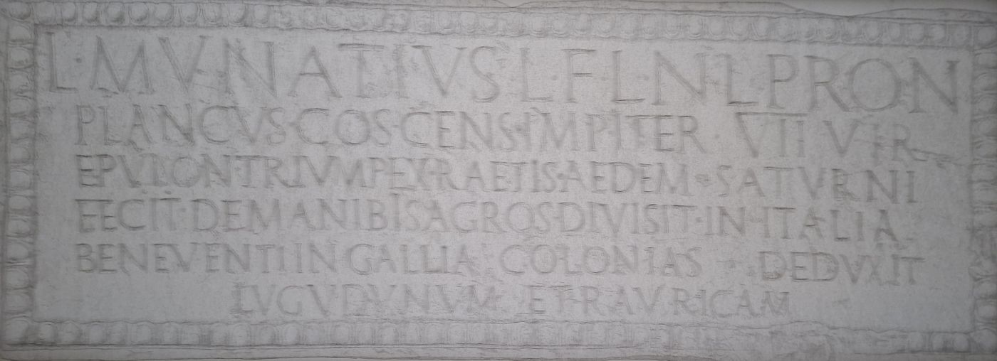
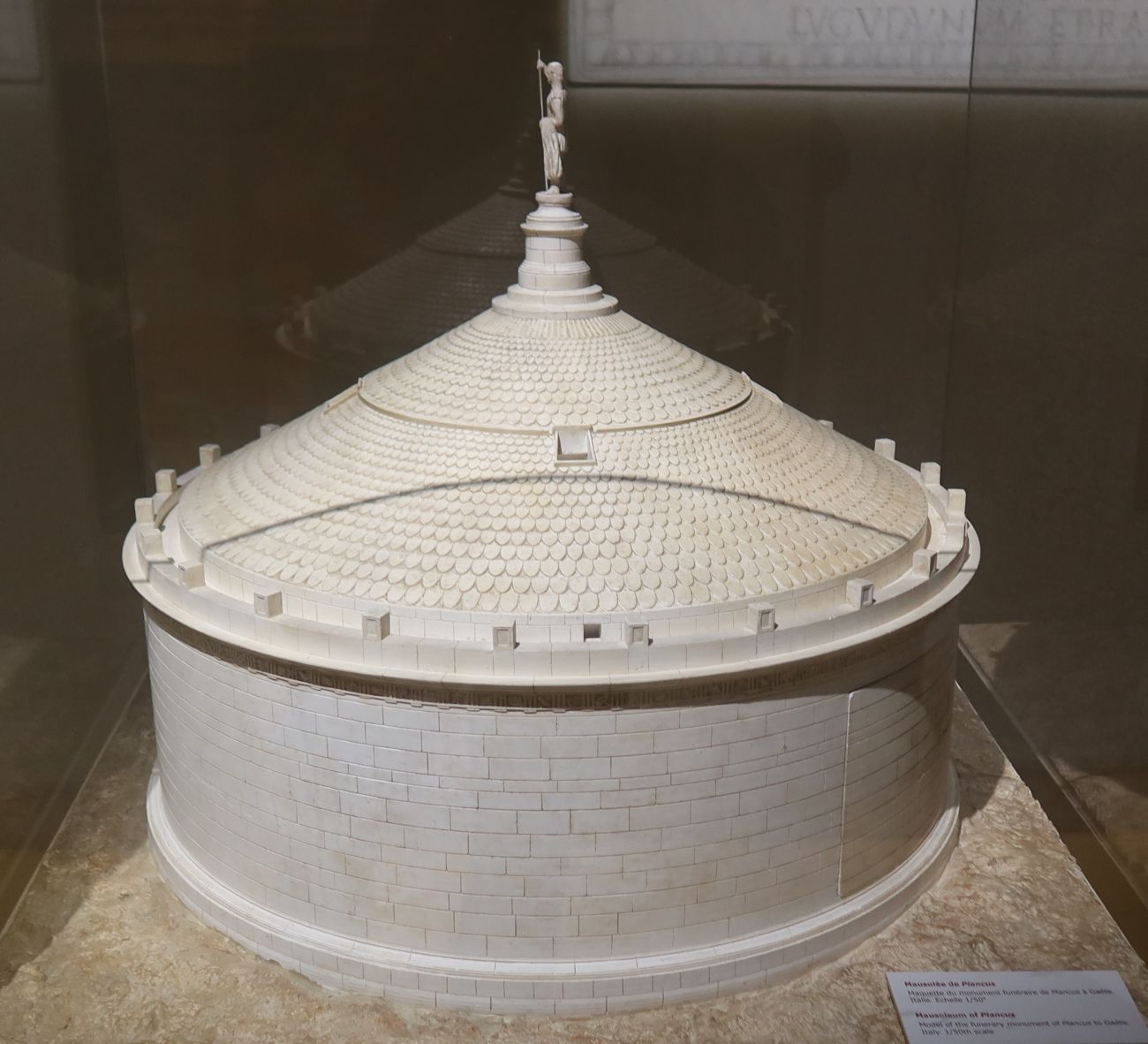
Model of the Mausoleum of Lucius Munatius Plancus in Gaeta. Collection: Musée gallo-romain in Saint-Romain-en-Gal

Roman era and Alemanni

The city of Basilia remained small in Roman times. The nearby Roman colony Augusta Raurica (Augst) was a large provincial town at the time. The Augusta Raurica Museum provides a detailed account of this history. After the Romans left around 400, the arrival of the bishop was crucial for the town’s development.


The bishop and the prince-bishopric

Basel became the new bishop’s seat, probably because of the invasions of the Germanic tribes (the Alemanni) at the end of the fourth century. The bishop previously had its seat near Augusta Raurica. The hill on which the cathedral was built provided a good refuge. Until the Carolingian Empire of Charlemagne (742-814), the diocese and the city led an unremarkable existence (politically and culturally).

Two bishops stood out in this period: Waldo (740-814) and Haito (762-836), cultural innovators and advisers to Charlemagne. In 999, the diocese would also become a secular and military power. In that year, the diocese acquired the rights of the abbey of Moutier-Grandval (a gift from Rudolf III (971-1032), the last king of Burgundy).

Around 1000, the bishop became a vassal of the Emperor of the Holy Roman Empire and thus a prince, marking the inception of the prince-bishopric, which is distinct from the ecclesiastical province or diocese. The (financial) involvement of Emperor Henry II (953-1024) made the construction of the Münster possible. The Sculptures of the emperor and his wife Cunegonde (980-1033) are visible in various places.

With the acquisition of St Ursanne Abbey in 1146 and through military expeditions in the 13th century, the Principality became the most potent secular power on the Upper Rhine. Its territory included today’s Jura, the Sundgau, southern Alsace, Birseck, and Birstal, as well as scattered possessions in southern Germany.

The City

In the 13th and 14th centuries, the power of wealthy citizens and guilds increased steadily. Due to its location, Basel was a trade hub and already an imperial free city (Reichsunmittelbarkeit).

After losing battles (1315, 1386, 1388 and 1415, the loss of the Aargau and Baden, including the essential archives with all documents and treaties, restitution in 1474 by the Ewige Richtung/Eternal Peace Treaty, Innsbruck, Vienna and in Vorderösterreich, Ensisheim and Freiburg were the centres of government.

A major earthquake destroyed much of the city and almost all its churches in 1536. At that time, Basel was still divided into Kleinbasel, located on the right bank of the Rhine, and Grossbasel, situated on the left bank of the Rhine. Kleinbasel fell under the Diocese of Constance and the Archbishopric of Mainz until 1801. Grossbasel was a diocese of the Archbishopric of Besançon.

Another crucial moment was the construction of the Mittlerbrücke in 1225. Trade and population increased rapidly, and both Basel were united in 1392.
Basel had close connections with the Alsace and Baden regions, as well as the Confederation. However, the city remained neutral in military conflicts.

Unknown artist. Dreiländermuseum Lörrach

However, in 1444, the town was the scene of a battle between French troops and the Eidgenossen (the Battle of St. Jacob’s on the Birs, 26 August 1444). This battle occurred during the Council of Basel (1431-1449).

St. Jacobs Kapelle

The University of Basel was founded in 1460 with the support of Pope Pius II (1405-1464). The city became a centre for publishing, printing, humanism, and science. Basel remained neutral in the Burgundian Wars (1474-1477) and the Schwabenkrieg (1499).

1501-1529

The accession of Basel to the Eidgenossenschaft in 1501 complicated relations between the bishop and the city. After the bishop and the (aristocratic) chapter’s departure in 1529, the city council and elite were the main political forces.
The Catholic Erasmus of Rotterdam (1467-1536) lived in Basel and was buried in the Protestant Münster in 1536.

Basel acquired the villages of Riehen and Bettingen in this period. They are the two other municipalities of the canton nowadays.

1798-1848

After Napoleon’s fall, Basel joined a new confederation in 1815 with part of the territory of the Principality of Basel (the Birseck). In 1833, there was a split between Basel-Stadt and Basel-Landschaft (Baselbiet). In 1848, the new constitution gave both cantons the status of semi-canton (with one seat in the Ständerat per canton instead of two).

1875

In 1875, the canton introduced a new constitution including the following features:

The introduction of the separation of powers, universal suffrage (for men, with the introduction of women’s suffrage following in 1966), the popular initiative, and the referendum (including the mandatory referendum for all constitutional amendments and the optional referendum). The Citizens’ rights go further in the canton than at the federal level.

Government

The Grand Council (der Grosse Rat) is the legislature. This institution, a tradition dating back to the Middle Ages, is elected every four years under the proportional system (Proporzsystem). The seats (200) are allocated to the parties according to the number of votes. The Government Council (Regierungsrat) is the executive. The governing council is elected according to the absolute majority system (Majorzsystem).

What distinguishes Basel-Stadt from the other cantons is that the Government Council and the Grand Council are responsible for both the canton of Basel-Stadt, including the municipalities of Riehen and Bettingen and the city of Basel.

Town Hall of the City of Basel

The flag

The flag symbolises the episcopate and the diocese of Basel. What remains of the bishop is the city’s heraldry: the black bishop’s staff. The bishop’s staff is the heraldry of the canton of Basel-Stadt, which was already known in the 13th century.

In the 11th and 12th centuries, the bishop already used the red bishop’s staff to show the identity of the Prince-bishopric. The red bishop’s staff was the bishop’s heraldry, still visible on the flags of the Cantons of Jura and Basel-Landschaft.

(Source and further information: A. Berchtold, Bâle et l’Europe. Une Histoire culturelle (Deux tombes, Lausanne 1991).

Medieval and modern Basel

Kanton Basel-Stadt, view from Ötlingen (Baden)

Hotel Les Trois Rois

Numa Donzé (1885-1952), Johannes der Taufer (John  the Baptist), 1919, the city has around 250 springs and sources of water

Laterne, Fasnacht 2023

The old FCB-Stadion in Kleinbasel

Canton Basel-Landschaft

The Canton of Basel-Landschaft (Baselbiet) was created in 1833 as a split-off from the Canton of Basel, which had been a member of the Confederation since 1501.

1501-1833

In 1501, the city of Basel was the dominant political power in the canton of Basel. The area beyond the city walls was an Untertanengebiet ruled by a governor.

The French invasion in 1798 and the dissolution of the prince-bishopric marked the end of the city’s dominance for a short time. The Helvetic Republic (1798-1803) abolished all cantons and their privileges, as well as the Untertanengebiete.

The Act of Mediation (1803) ended this republic, and the Canton of Basel regained its power over Baselbiet in the new Confederation (1803-1813). The Vienna Congress (1814-1815) confirmed the situation. Additionally, the Birseck district was incorporated into Basel. This district belonged to the principality of Basel until 1798.

However, the clock could not be turned back, and opposition to Basel’s domination and the ancien régime grew in the 1815-1830 period. Taxes were again the trigger for resistance to the city.

It led to a provisional government of villages and communes in 1831. On 17 March 1832, 46 municipalities founded the new canton of Basel-Landschaft.

The city intervened with troops, but they were defeated in August 1833. On 26 August 1833, the Tagsatzung (the representation of the cantons) agreed to the separation and created the two half-cantons, Basel-Stadt and Basel-Landschaft, each with one seat in the Ständerat instead of two per canton.

Several referendums and attempts at reunification took place in vain. The last attempt was in 2014.

Flag

The heraldry features a red bishop’s staff, but in a mirror image, turned to the right.

(Source: Die Geschichte der Schweiz, Basel, 2014).

The St. Leonard Church Basel

The originally Romanesque church of St. Leonhard towers high above the Barfüsserplatz in the centre of Basel. The first construction of the parish church dates from around 1080. Nearby buildings housed the Augustinian monks.

The church bells determined the rhythm of life. Only the crypt of the Romanesque building has been preserved. The earthquake of 18 October 1356 razed the Romanesque church to the ground (except for the crypt).

The rebuilding took place in the Gothic style. Shortly before the Reformation, the last major renovation in the High Gothic style took place (1481-1521). The first Protestant services occurred in 1525, and the church and abbey were transferred to the city. This early transfer is why the church was spared the iconoclasm of 1529. The statues and altars had already been removed and stored, including an altar by Konrad Witz (1400-1446).

The windows from the beginning of the sixteenth century also survived the Reformation. The church is now the French Reformed Church of Basel.

(Église française réformée de Bâle).  Source: P. Habicht, Chr. Ph. Matt, St. Leonhard. Ein Rundgang durch Kirche und Geschichte, Basel 2008).

Canton and City of Lucerne

Monasterium Luciara

The monastery of Lucaria was founded around 735. A bridge connected the monastery to the other side of the river Reuss. The settlement was one of the sixteen so-called Dinghöfe, land and territories owned by the monastery. The monastery’s name was first mentioned in 760, “ monasterium Luciara”. This settlement became the city of Lucerne (Luzern) around 1200. The lord of the town was the abbot of the monastery. The monastery of Mulbach (Alsace) was owned by the monastery.

Lucerne became an important city after the St. Gotthard pass opened around 1230. This development also attracted the attention of the Habsburgs. King Rudolf I (1218-1291) acquired the city’s rights shortly before he died in 1291.

Luzern and the elite of wealthy traders and merchants profited from the Habsburg administration and trading networks. However, the fiscal burdens were too high. The city concluded an alliance with Uri, Schwyz and Unterwalden and joined the Eidgenossenschaft in 1332. Lucerne also participated in the war against the Habsburgs in 1386 (Battle of Sempach).

The city became an imperial free city (Reichunmittelbarkeit) in 1415. The reformation divided the Eidgenossenschaft. Lucerne remained Catholic. The Federal Constitution and the Confederation resolved 1848 the religious tensions after the Civil War in 1847 (Sonderbundskrieg).

Canton Solothurn

Solothurn (Soleure) has a long history that goes back to the prehistory of the Celts and the Romans. The Celtic name of the settlement was Salodurum (watergate), a name adopted by the Romans.

The town became a free imperial city (freie Reichsstadt) of the Holy Roman Empire in 1281. For two centuries, it acquired the territory of the present-day canton of Solothurn (the last enlargements date from 1530). After a period of alliances, Solothurn became a full member of the Confederation in 1481.

The canton’s capricious borders indicate a complicated process that lasted many centuries. The territory was disputed by (noble) families, abbeys, other cities (cantons), and other contenders.

The numerous monuments and buildings showcase the city’s development in terms of religion, military, politics, and commerce.

Solothurn remained Catholic, as witnessed by the Jesuit church (1680-1689) and the seat (since 1828) of the diocese of Basel. Basel adopted the Reformed faith between 1525 and 1529. The bishop first moved his seat to Porrentruy (Pruntrut) and, in 1828, to Solothurn.

One of the many unique historical buildings is the Zeitglockenturm, built in 1545. The astronomical clock has three functions. The clock indicates the hours of the day and night, as well as the location of the sun and the moon. The tower was built in 1152 by Duke Konrad of Zähringen (1090-1152) as part of the castle.

The defensive walls and the eleven bastions were demolished in the nineteenth century, except for the Riedholzturm and the Krummturm.

The many beautiful streets, well-maintained public and private buildings, and monuments give a good impression of the city’s grandeur and wealth. The town was the location of the French embassy to the Confederation for more than 250 years (1530-1792).

The lucrative commercial ties with France focused particularly on the mercenaries’ business. The French king was very impressed by the Swiss fighting spirit and power. This trade financed many splendid public and private buildings in the city.

The town is a true (baroque) jewel along the river Aare nowadays.

The Canton of Graubünden

The Raetians inhabited the territory of today’s canton of Graubünden before and during Roman rule (15 BC – 410 AD). The Raetian-Roman language and culture (Romansh) originated from the languages of these tribes.

The Raetians are a collective name for many tribes which inhabited the area before the arrival of the Romans. Their origin is not known. Roman and Greek authors used the term. The language in the Roman period (13 BC-410 AD) was a mixture of Latin and Raetian, known as Raetian-Roman. The language still exists and is known as Romansh today, one of Europe’s oldest languages.

The influence of German-speaking immigrants from the north after the seventh century, from the west (the Walser) in the twelfth and thirteenth centuries, and the tourism and industrial boom in the nineteenth century changed the linguistic landscape. Around 50,000 people still speak Romansh, almost the same as in 1870!

The area was divided into many sovereign territories, abbeys, monasteries, and secular states. The Landsgemeinde played an essential role in becoming increasingly detached from the sovereign.

In the most extreme cases, the emperor and king (usually a Habsburg) ruled the region. The Bishop of Chur was a prince of the Holy Roman Empire and a secular ruler of the Prince-Bishopric of Chur.

Collection: Rätisches Museum 

The canton of Graubünden emerged from the alliance of the three leagues in the 14th and 15th centuries. The area was then formally part of the Holy Roman Empire but had been acting increasingly independently.

The Gotteshausbund (League of the House of God) was founded in 1367. The Graue or Obere Bund (the Grey League) followed in 1395, and the Zehngerichtebund (the League of the Ten Jurisdictions) in 1426.

These three leagues closely cooperated and concluded treaties with foreign powers and the Swiss Confederation (Eidgenossenschaft). In 1524, the three leagues merged into the Republic of the Freistaat der drei Bünde (Republic of the Free State of the Three Leagues). This republic already had close ties with the Eidgenossenschaft of thirteen members and the status of zugewandter Ort.

In the centuries after 1524, the Reformation, foreign interference (including during the Bündner Wirren, 1618-1639), and Napoleon’s constitutional reforms (1798-1813) were decisive in the creation of the trilingual canton of Graubünden in 1803.

In 1803, the new canton became a member of the Confederation (1803-1813), the successor to the Helvetic Republic (1798-1803). Graubünden became a member of the new Confederation in 1815.

Chur, RBB headquarters

The flag

The namesake of the canton is the Graue Bund. However, the canton’s banner shows the heraldry of the three leagues.

(Source: Historisches Lexikon der Schweiz, Kanton Graubünden, https://hls-dhs-dss.ch/de/articles/007391/2018-01-11).

The canton and city of Fribourg

The city of Fribourg/Freiburg was founded by Duc Berthold IV of Zähringen (1125-1186) in 1157.

1157-1536

Fribourg joined the Swiss Confederation (Eidgenossenschaft) in 1481. The Burgundian wars (1474-1477) were decisive. The relationship with Habsburg and the Holy Roman Empire was also tense.

Emperor Maximilian (1459-1519) introduced new taxes in the 1490s. The cities, Orte or cantons of the Confederation, still belonged to the Holy Roman Empire but were independent. They resisted the levy of new taxes.

Habsburg also conflicted with the three leagues in Graubünden (Zehngerichtebund, Gotteshausbund, Graue or Obere Bund). The Eidgenossen supported the three leagues.

Maximilian lost the Schwabenkrieg (or Schweizer-or Engadinerkrieg) in 1499. However, France defeated the Eidgenossen in 1515 (Marignano). The peace treaty with France was signed in the Hotel de Ville in Fribourg on 29 November 1516. The eternal Peace, la Paix éternelle, der ewige Friede, lasted until the French invasion in 1798.

The Reformation divided the Eidgenossenschaft after 1520. Freiburg remained Catholic. Bern became Protestant. Freiburg became a bastion of dogmatic Catholicism but remained an ally of the Protestant canton of Bern until 1798.

1798-1848

Freiburg followed the history of the Swiss Confederation in the crucial years 1798, 1803-1813, 1815 and 1848.

(Source: H. Walter, Histoire de Fribourg, Une Ville-État pour l’éternité (XVIe-XVIIIe siècle), Tome 2, Neuchâtel 2002).

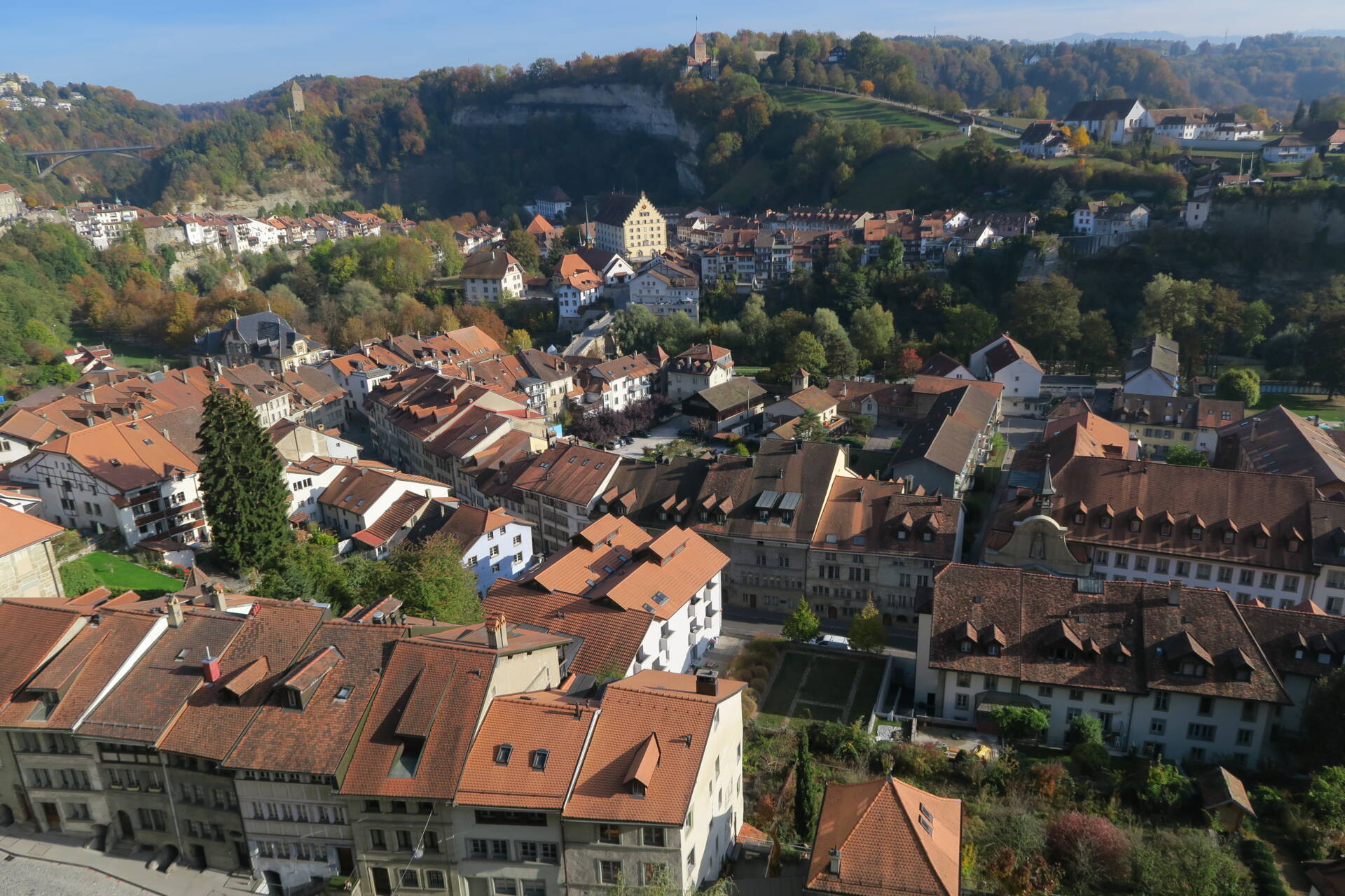
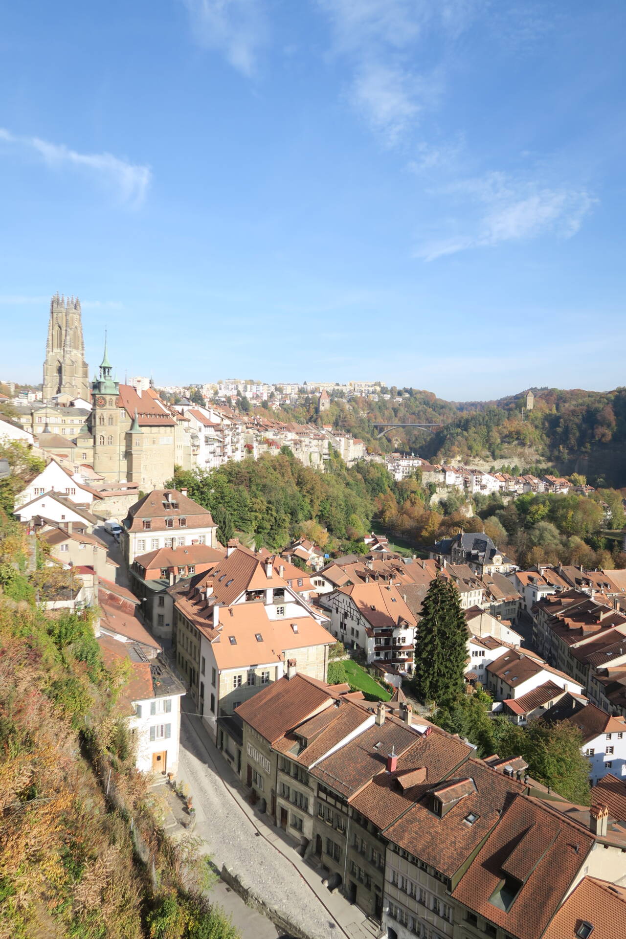
Impressions of the city of Freiburg/Fribourg