The Significance of Morgarten

On 15 November 1315, a battle took place at Morgarten (canton of Zug) between the first Eidgenossen (Uri, Schwyz and Unterwalden) and Duke Leopold of Habsburg (1290-1326). Little is known about the course of the battle. Only the winner (the three Eidgenossen), the loser (Duke Leopold), and the ambush for Leopold are known.

The fact is that Schwyz had plundered the Habsburg monastery of Einsiedeln in 1314, and possibly Leopolod’s reaction was punitive. Another theory is the throne battle between Ludwig of Bavaria and Friedrich of Habsburg (Leopold’s brother) as German kings in the Holy Roman Empire. Schwyz supported Ludwig.

Morgarten and the Ägerisee today

Nevertheless, Morgarten on the Ägerisee went down in history as the first battle of this Swiss Orte for more freedom and autonomy (not yet for independence and sovereignty; that was not an issue). Nobody foresaw or wanted the Confederation of 13 cantons in 1513, let alone the Confoederatio Helvetica of 1848. This development is another story.

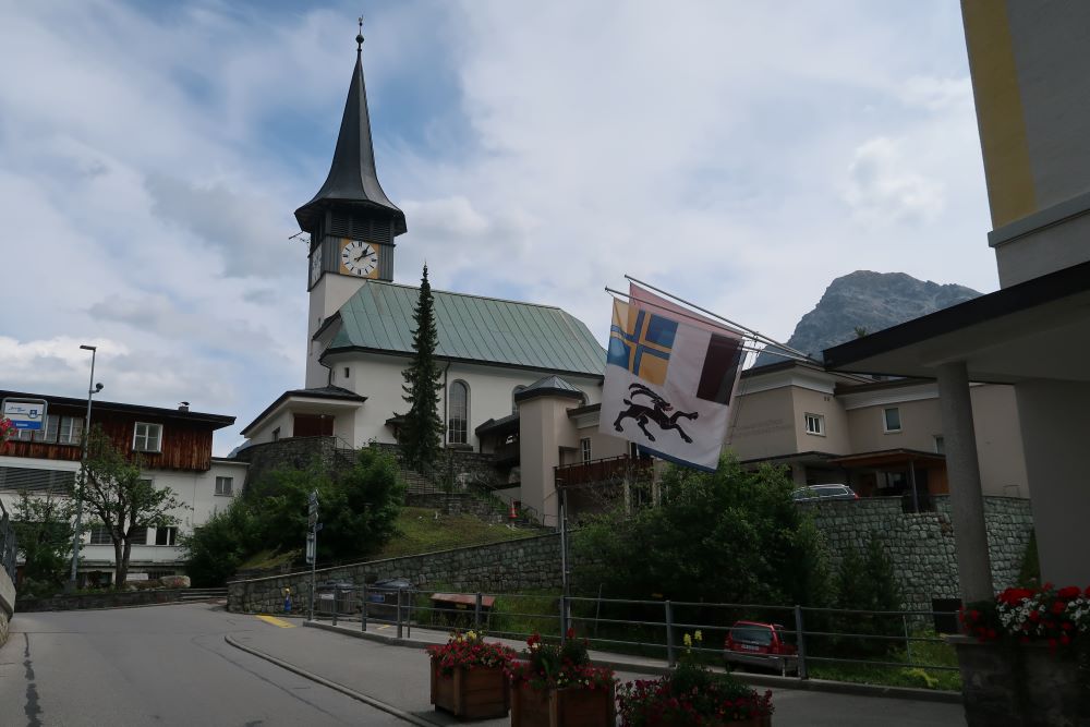
The church of Sattel

The events of 1315 are (speculatively) recalled and pictured at various points on the Morgarten trail (themed path). The trail starts at the Morgaten monument on the lake and leads to the parish church in Sattel (canton of Schwyz).

Morgarten Memorial (1908). This monument reflects the sensitivities between and the identity of the cantons. The memorial stands on the territory of Zug, then the loser and Habsburg territory in 1315. For this reason, Canton Schwyz, the winner, did not participate in the dedication on 2 August 1908. Federal involvement and the beautiful location on the Ägerisee led to the choice of canton Zug.

The information centre offers insights and extensive documentation on this history, explaining its significance. The Morgartenbrief or the ‘Bund von Brunnen’ of 9 December 1315 (Bundesbriefmuseum in Schwyz) uses the term ‘Eidgenosse’ for the first time. It is a covenant between the “lantlüte von Ure, Szwits und Unterwalden“.

It was a covenant for mutual support, preservation of peace, and conflict resolution: a Landfriedensbündniss (among other things about the use of grazing land, theft of cattle, and other offences), not a declaration of independence.

On the contrary, the lord of the land is recognised unless he does not recognise the rights of the Orte in connection with the autonomy already granted in the 13th century (Reichsunmittelbarkeit). These agreements were standard in many places in the Holy Roman Empire during this period. Only the ancient Eidgenossenschaft, however, made it through the 18th century and the French invasion in 1798.

The Morgarten Information Centre left the Letziturm, right the Information Centre and the oldest European Wooden House (1176). The Letziturm was the border between Schwyz and Zug, which still belonged to Habsburg in 1315.

Stefan Hawking (1942-2018) once replied to a question about the origin of the first minuscule beginning of the universe: “Then I’ll stop thinking; otherwise, I’ll go mad”.

Some writers might do the same instead of having endless scientific discussions and writing books on myths, legends or facts, William Tell, the Rütlischwur. 1291 or the Bundesbrief 1315. As if the goddess Athena (namesake of the city of Athens) or Romulus and Remus (founders of Rome) are subjects of similar discussions.

(Source: B. Meier, Von Morgarten bis Marignano, Baden 2008; Informationszentrum Morgarten). 

The chapel and its interior

The first Eidgenossen, Wilhelm Tell and Gessler in Europapark (Germany).

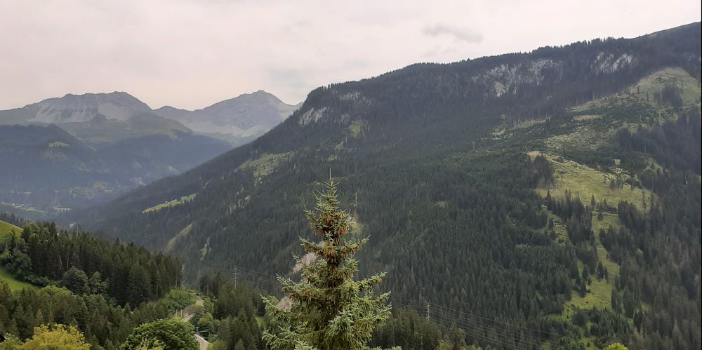
Impressions of Morgarten and surroundings

Arosa, Lenzerheide and Tschiertschen

The ancient episcopal town of Chur is located near Reichenau, where the Hinterrhein and Vorderrhein converge to form the Alpine Rhine in the Rhine Valley, continuing up to Lake Constance (Bodensee). Chur is also the traffic hub for the direction of Arosa, Lenzerheide, Disentis/Mustér and the most beautiful village in Switzerland and Liechtenstein: Tschiertschen.

Chur seen from the road to Arosa

Arosa and the Schanfigg Valley

The first written indication of Schanfigg is Scanavico in the year 765. The villages of Lüen (1084), Castiel (1132), St Peter (831), Pagig (1160) and Calfeisen (1156) are also ancient villages, where Romanesque was the language of communication until the 16th century.

From Davos, a Walser village, Walser immigrants came over the Strelapas to the Schanfigg Valley in the 13th and 14th centuries. They founded Arosa and Langwies.

With the extinction of local noble rulers (in 1338, the Freiherren von Vaz and in 1436, the Counts of Toggenburg), autonomous Gerichtsgemeinden also developed in this barren area.


Villages in the Schanfigg Valley

Arosa and the other villages were part of the Gerichtsgemeinde Davos, the capital of the Zehngerichtenbund (1436). Langwies was also a Gerichtsgemeinde. St Peter was part of the Gerichtsgemeinde (Ausser)Schanfigg, but was the location of the Landsgemeinde of the Schanfigg valley.

The Zehngerichtenbund concluded a treaty with the Gotteshausbund (1367) in 1450 and with the Graue or Obere Bund (1395) in 1470. However, the Gerichtsgemeinden remained autonomous (apart from their formal status as part of the Holy Roman Empire until 1648 and the Peace of Westphalia) until their dissolution in 1798.

Apart from the Reformation from 1530 onwards and the devastation in 1622 at the time of the Thirty Years’ War (1619-1648), little changed politically, socially, and economically in the predominantly poor agricultural existence of most residents.

The French occupation changed the political situation in 1798. The Freistaat der Drei Bünde was dissolved. And the Helvetic Republic (1798-1803), the Confederation (Act of Mediation) and the establishment of the canton of Graubünden (1803-1813), the new Confederation in 1815 and finally the New Constitution of 1848 were the new political realities.

Arosa (with only 56 inhabitants by then) became an independent municipality in 1851. However, tourism changed Arosa in the following decades. The village evolved into a renowned winter sports and tourist destination. As a result of these developments, Arosa had over 3 300 inhabitants in 1930, fifty times more than half a century before!


Arosa today

The first hotel opened in 1877, followed by the first sanatorium in 1888. The Chur-Arosa road was completed in 1890, but the canton had banned motorised vehicles until 1925. Since 1914, trains have been running between Chur and Arosa with a 264-long and 62-high viaduct at Langwies. The Rhaetian Railway operates this railway with a rise from 593 to 1738 metres in less than an hour!

Langwies viaduct

The trip from Chur to Arosa through the Chanfigg Valley, by car, train, bicycle, motorbike or on foot, is worthwhile in all seasons. While the other villages have benefited far less from tourism, it is a blessing for the preservation of the equally ancient buildings. Today, the villages in the valley are incorporated into the municipality of Arosa.

The Schanfigg Valley

Chur seen from the road to Lenzerheide

Lenzerheide, Malix and Churwalden

Lenzerheide has a similar history to Arosa. It was also a tiny Walser village on the way to Tiefencastel. From the mid-nineteenth century, tourism also changed the life and appearance of the town here.

Lenzerheide

Heidisee near Lenzerheide

However, the route to Lenzerheide is more interesting from a cultural-historical perspective. The Walser people also settled here in the 13th and 14th centuries. The old monastery (9th century) and Abthaus (15th century) in Churwalden, the ruins of the castle (around 1150) of the Freiherren von Vaz in Malix or beyond Lenzerheide, and the Val Obervaz are some highlights.

Remains of the castle near Malix

Churwalden monastery

The Monastery and Abtshaus Churwalden. Johann Rudolf Rahn (1841-1912), Churwalden Abbey, on the right, the still-existing abbot’s house on the left. Drawing around 1900. Zentralbibliothek Zürich, Graphische Sammlung and Fotoarchiv

Tschiertschen, Pagguss and Praden

The road to Lenzerheide, however, holds another secret. The turnoff to the village of Tschiertschen is the road to ‘the most beautiful village in Switzerland‘. Moreover, in the Pagguss Gorge, the village of Pagguss is home to the EHL Hotelfachschule.
Tschiertschen is known, among other things, for its Romanesque-Gothic church, dating back to the 14th century.

EHL Hotelfachschule.


The Pagguss-Schlucht

The village of Praden shared the church and cemetery with Tschiertschen for a long time. Still, politically, Praden belonged to the Gerichtsgemeinde Langwies, and Tschiertschen to the Gerichtsgemeinde Churwalden, both of which were members of the Zehngerichtebund.

However, the history of Praden and Tschiertschen continues. The Reformation took place in 1540, obviously after a vote among citizens; moreover, the parish priest was allowed to stay on until his death, and only then (1550) was a preacher appointed!

Tschiertschen

The two villages, Langwies and Churwalden, fell under different courts but shared the church and cemetery in Tschiertschen. A plague epidemic in 1627 caused some of Chur’s elite to flee to isolated Tschiertschen in 1629. However, the victims of the plague in Praden were also buried in Tschiertschen. The refugees from Chur wanted to prevent it because of contamination risks.

Praden

Praden built its church and cemetery with money from Chur residents around 1630. Tschiertschen did not accept it for financial reasons. After all, Praden no longer shared in the costs of the church in Tschiertschen. A legal battle ensued between courts in Langwies and Churwalden, a court of appeal in Davos, and an arbitration commission in Chur.

The legal proceedings lasted until 1762. Then, in a final judgment, the court decided that every household in Praden should deliver to the parish in Tschiertschen an annual Füederli (a piece of firewood). In any case, the fact is that both churches are still there, one even in the ‘most beautiful village in Switzerland’.

(Source and further information: Arosa and Lenzerheide; M. Domann, G. Jäger, Die Kirche von Tschiertschen, Tschiertschen, 2014)

The Lion Monument of Lucerne

The Lion Monument (Löwendenkmal) was inaugurated on 10 August 1821, 29 years after the attack on the Tuileries in 1792. One of the few surviving Swiss guardsmen was Carl Pfyffer von Altishofen, an officer in the Swiss Guard Regiment of King Louis XVI (1754-1793).

On 10 August 1792, he was in Switzerland; otherwise, he would have shared the fate of the guardsmen. Most died that day;  the survivors were executed on 3 September.

Carl Pfyffer initiated the monument. During the French occupation, it was politically impossible to build it. In 1815, supported by the restoration’s conservative mood, he realised his plan to commemorate his colleagues.

Carl Pfyffer collected 20,000 Swiss Francs through donations from home and abroad, including from members of the royal houses of Russia, Prussia, and France.

The commission was obtained by the well-known Danish sculptor Bertel Thorvaldsen (1770-1844). The lion was carved directly from the stone wall in the old quarry, which Pfyffer had leased for this purpose since 1805.

The monument was to be a lion in the style of ancient models. The carving of the lion was not without drama. The Solothurn sculptor Urs Pankraz Eggenschwiler (1766-1821) carved the lion directly into the wall of the former sandstone quarry on the edge of Lucerne, but he did not survive the work.

After his fatal accident on the construction site, Lukas Ahorn (1789-1856) completed the monument. The accompanying text is Helvetiorum Fidei ac Virtuti (on the loyalty and courage of the Swiss).

The dying lion is pierced with a broken spear. His leg rests on a shield with the Fleur-de-Lys of the French royal family. Another shield bears the coat of arms of Switzerland. The inscription under the lion contains the names of the officers and the number of victims and survivors.

The inauguration on August 10, 1821, was a celebration of the Ancien Régime. Ambassadors and representatives from royal houses and aristocratic Europe were present. Today, the monument attracts tourists from all walks of life.

(Source: B. Schumacher, Kleine Geschichte der Stadt Luzern, Baden, 2015; www.loewendenkmal21.ch).


The Crucifixion Panorama in Einsiedeln

The last third of the 19th century witnessed a great interest worldwide in panoramas. A panorama is a gigantic circular painting up to 15 metres in height and 120 metres in circumference.

At the end of the 19th century, many big cities had rotundas exhibiting panoramas. During this period, the idea arose to represent the historical event of the Crucifixion of Christ in a panorama.

The landscape

Karl Hubert Frosch (1846-1931), Joseph Krieger (1848-1914), and William Robinson Leigh (1865-1955) painted the panorama of Einsiedeln in 1892. On 1 July 1893, the panorama of the Crucifixion of Christ was unveiled to the public in Einsiedeln, housed in a twelve-sided dome measuring 33 metres in diameter, built explicitly for the purpose. It would very soon become a well-visited site of the pilgrimage centre.

A fire destroyed this panorama in 1960, but its second life began immediately. A new panorama fireproof building was erected, and to recreate the painting, an artistic competition was held, which was won by the Viennese artists Prof. Hans Wulz (1909-1985) and Prof. Josef Fastl (1929-2008). The idea was to paint something other than an exact copy or a reproduction of the former picture. The new concept would be executed in a modern style, reflecting a contemporary artistic interpretation of the subject.

The crucifixion on the Golgatha

The burial site of Christ

The new panorama was painted in 1961/62, within six months, following the former picture in size and all details of the composition, but in a free painting style which differs from the detailed, realistic style of the earlier one. On 14 April 1962, the panorama was reopened to the public.

Over the last hundred years, nearly five million pilgrims and tourists have visited it. Three panoramas (out of many) of the Crucifixion of Christ have survived worldwide, all in pilgrimage centres: in Ste. Anne de Beaupré, situated near Québec, Canada; Altötting, Upper Bavaria, Germany; and Einsiedeln, Switzerland.

(Source and further information: Panorama Einsiedeln)

The palace of Herodus and the three towers Mariamne, Phasael en Hippikus

Rolle, De la Harpe and the Tsar

The town of Rolle (canton of Vaud) decided to give the name De la Harpe to the newest island in Lake Geneva after the death of Fréderic-César de la Harpe (1754-1838). Rolle is a port town on Lake Geneva. A dyke was built in 1835 to protect the boats in the harbour from the wind.

For centuries, most transports in this region took place across the lake. The boats carried stones from the Meillerie quarry (Haute-Savoie) on the French side of the lake and wine, cattle, cheese and wood from the Swiss part.

An island was constructed before the dyke in 1837 to give even more coverage to the ships. Large boulders from Meillerie and tonnes of rubble covered the piles and other remains of pile dwellings of the Celtic inhabitants from centuries before Christ.

Vaud was still under the rule of Bern in 1754, a so-called Untertanengebiet (occupied territory/territoire sujet). Fréderic-César de la Harpe left for St Petersburg in 1782 to the court of Empress Catherine II (1729-1796). The empress entrusted him with the education of her grandsons, the future Tsar Alexander I (1777-1825) and Constantine (1779-1831). In 1795, he returned to Switzerland.

Jacques-Augustin-Catherine Pajou (1766-1828), Portrait of Fréderic-César de la Harpe, 1803. Musée historique Lausanne. 

1798 he pleaded with the French Directory for Vaud’s independent status. In 1798, Napoleon appointed him the chief administrator of the short-lived Helvetic Republic (1798-1803). Napoleon founded this republic after occupying the Confederation of thirteen cantons in 1798.

However, the thirteen cantons resisted the new centralised republic, a French model. Napoleon replaced this republic with a new Confederation of nineteen cantons in 1803, including the new canton of Vaud.

In 1815, after Napoleon’s defeat, Vaud remained a sovereign canton in the new Confederation, partly due to the intervention of Tsar Alexander I and La Harpe, as did the new cantons of Aargau, Thurgau and Ticino, former Untertanengebiete as well.

De la Harpe enjoyed great prestige and respect in Europe. In 1844 several monarchs visited the island to see the obelisk in memory of this statesman.

Geneva has Pictet de Rochemont (1755-1824), Vaud has Fréderic-César de la Harpe.

(Source and further information: www.rolle.ch)

Geneva, Pictet de Rochemont

Maienfeld, Heididorp and Walser

You pass them so quickly, all those beautiful villages, towns and nature in Switzerland. Some have a well-known tourist attraction or another reason to stop, such as Maienfeld (canton of Graubünden), located at the foot of the Heidi village.

Heidi, who doesn’t know her? The writer Johanna Spyri (1827-1901) created her and her village in 1881. Who, however, knows Maienfeld? In Roman times, it was already a place of significance, known as Magia, and was listed as such on the Peutinger map.

For centuries afterwards, the town was the seat of the region’s most influential families and bishops for the Diocese of Chur. This bishopric was one of the first and most important north of the Alps and stretched as far as Vintschau (South Tyrol in Italy), Vorarlberg (Austria) to Lake Constance (Bodensee).

Throughout history, Maienfeld was an Untertanengebiet of the Freestate of the Three Leagues (Freistaat der Drei Bünde, 1510-1798), the French invasion, and the Helvetic Republic (1798-1803). Since 1803, it has been a municipality in the canton of Graubünden. Picture: the appointment of the last bailiff in 1797.

Maienfeld received city rights from the emperor of the Holy Roman Empire as early as the 11th or 12th century. It also indicates the town’s significant political and economic role. The first castle was built in the 10th century by the Counts of Bregenz. Other owners were the Counts of Tübingen, the Freiherren of Vaz, the Freiherren of Aspermont (who built the current castle in the 13th century), and the Counts of Toggenburg. The Freiherren of Brandis acquired the castle in 1438 and have been known as the owners of Brandis Castle ever since. Today, the castle is privately owned and operated as a restaurant.

Brandis  Castle,  the ancient city wall, and the wall of the monastery court

The famous “Waltensburger Meister” painted one of his Gothic murals on the castle walls. The medieval town centre, including the town hall, Amandus (11th century), Luzi (1457), and several monastery buildings, deserves special attention. Maienfeld did not have a monastery, but the Churwalden (Hinterrhein) monastery had some buildings and a monastery court.

The castle and the church

The Bruder Klausen chapel in Protestant Maienfeld

The ‘Klostertorkel’ is a reminder of this period. A Torkel is where grapes were pressed, and monks stored wine. However, the reformation in the 1529s marked the end of their presence. Citizens continued the Viticulture, however. Until the sixteenth century, Romanish was the spoken language, and the town was called Maiavilla. The Germanisation followed soon afterwards.

The Klostertorkel

The vineyards are not only located outside the town, but also within it. Sheep feast on the grassy meadows. As in many Swiss villages and towns, Maienfeld has developed its specialised industries. The timber industry is this, with a creative entrance as its gateway.

The Heidi Village is within walking distance. The village gives an insight into farm life in the nineteenth century. A special feature is the Walser origin and influence, as seen on the town hall wall (Rathaus). After all, Graubünden was an important destination for immigrant Walser in the late Middle Ages. For instance, Davos, the capital of the Zehngerichtenbund, was a Walser town!

(Source and further information: Commune of Maienfeld)

Johanna Spyri (1827-1901) in the Johanna Spyri Haus in Maienfeld

Heidi Village (Heididorf)

Heidihaus

Rathausstal

The town hall (Rathaus) with the Walser dedication

Impressions of the Rhine Valley near Maienfeld

Pfäfers Monastery near Bad Ragaz (canton St. Gall)

Bad Ragaz, the Bathhouse and Grand Hotel

The history of the bathhouse (Dorfbad) is closely linked to the use of the thermal spring in the Tamina Gorge and the success story of Bad Ragaz (Canton of St. Gallen) after 1850.

The story began in 1840 when Bernhard Simon (1816-1900) took over the estate “Hof Ragaz” from the Canton of St. Gallen. He built first-class spas in the village.

The canton built the bathhouse in 1866 and 1867, primarily for hygiene. At that time, few people had a bathroom and hot water.


The spas and the grand hotel were obliged to maintain the bathhouse. This division of tasks functioned excellently for decades until the First and Second World Wars.

As of 2003, the bathhouse stood empty. However, the canton has subjected the monument to a complete renovation and restoration. The bathhouse is the last of its kind in Switzerland and now serves as a spa and wellness centre.

(Source and further information: Gemeinde Bad Ragaz).

Freudenberg castle

Muri Monastery

Count Radebot of Habsburg and his wife, Ita of Lorraine, founded the Benedictine monastery in 1027 on the territory of present-day Muri (Canton Aargau). Bishop Rumold consecrated the church of St. Martin on 11 October 1064.

The women’s convent moved to Hermetschwil in 1140. The Acta Murensia (1150-1180) are an essential historical source for regional political developments and the rise of Habsburg. In the 12th century, the Habsburgs built Havichsburg (Hawk) Castle in Habsburg, and the rise to power began.

Emperor Leopold, 1st (1640-1705) of the Holy Roman Empire, bestowed the dignity of an Imperial Prince on the abbot in 1701 and raised the monastery to the status of a prince abbey.

Eight centuries after 1027, the abbey developed into one of the wealthiest abbeys in Switzerland. The Romanesque crypt, the Gothic high choir and the Baroque central building bear witness to this status.

The stuccowork, frescoes and interior decoration of the later Rococo style unfold lavish splendour. The stained-glass windows are masterpieces of Renaissance stained-glass painting.

The Romanesque and Gothic three-nave basilica was rebuilt at the end of the 17th century. The result was the Baroque octagon, Switzerland’s largest sacred central room. The church’s five organs and acoustics are musical wonders from the 18th century.

In 1841, the canton of Aargau abolished and dissolved the monastery. The monks and the abbot moved to Gries near Bolzano and Sarnen (Obwalden). The convent of Muri continues to function there to this day.

The museum shows the impressive history of the monastery.

(Source and further information: Muri Monastery)

See also: Via Habsburg

Romanesque Church St. Niclà

The 12th-century Romanesque church in St. Niclà (Canton of Graubünden) is dedicated to St. Nicholas, the patron saint of sailors and children.

The church is located near the bridge over the River Inn (En in Romansh), along the old medieval road to Nauders. The Romanesque tower, the rectangular nave and the semicircular apse have been renovated.

After constructing a new road on the other (left) bank of the Inn in the sixteenth century, the church (and the bridge) lost its function and importance.

The west facade of the tower features a fresco of St. Christopher, accompanied by the coat of arms of the Porta and Von Marsch families. St. Christoforus is the patron saint of bridge builders.

The frescoes were painted around 1500. The Von Marsch family owned castles in Tarasp and Ramosch.

The church got a new vault in 1718. Soon afterwards, however, the church lost its function after the construction of a new church in Strada (1750).

The church was used as a warehouse and later extended with a farm. The secular use saved the Romanesque church in St. Niklà.

The Romanesque chapel in Donatyre (Canton of Vaud) and its beautiful wall paintings are another example of the combination of religious buildings and farming. The wall paintings are copies of the St. Etienne Church in Montcherand.

(Source and further information: www.san-nicla.ch).

St. Niclà and Strada